Florida Floodzone Services
Community of FEMA Registered Licensed Mapping Professionals,
Flood Zone & Insurance Consultants
Florida Floodzone Services
461 SE 3rd Terrace
Pompano Beach, FL 33060
ph: 954-290-7420
bspencer

Company information
Florida Floodzone Services (FFS) is a group of Florida Licensed Surveyors and Mappers. With our education and expertise we have been registered with FEMA as licensed professionals with the Department of Homeland Security – Federal Emergency Management Agency (FEMA). With our qualifications, we are able to provide full services in less time than other flood zone correction companies.
Our primary process utilizes the FEMA procedure called “Letter of Map Amendment” (LOMA). This program allows Florida Floodzone Services to petition FEMA for re-classification of the flood zone for an individual property. The basis for the LOMA application is to provide the “burden of proof” that your home is above the calculated Base Flood Elevation (BFE). Our field representatives will collect and certify the elevation data near your home to determine if your property is a candidate for a LOMA. Our final product will be the LOMA documentation from FEMA removing your home from the Special Flood Hazard Area (SFHA).

Portion of a FIRM map Pompano Beach, Florida
Based on locations of flooding water sources (rivers, lakes, oceans), FEMA has determined flood zone boundaries based on the topographic features and terrain as published in the Flood Insurance Study (FIS). These boundaries have been published on Flood Insurance Rate Maps (FIRM) issued by National Flood Insurance Program. Lenders will require flood insurance for any building lying on or within these defined flood zones. The numbers on the map above show the FIRM Base Flood Elevations in the shaded areas.

Florida Floodzone Services - Flood Simulation - FIS BFE 6.1'- Pompano Beach, FL
Florida Floodzone Services-Research Division has developed a process that can determine the potential damage area from the calculated base flood levels. With this information our licensed surveyors can determine the statistical probabilty of the structure being a candidate for the LOMA process. Please refer to the research page for more information.
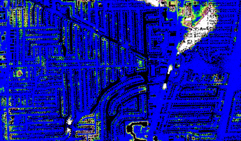
Florida Flood zone Services - Flood Simulation - FIRM BFE 7.0'-Pompano Beach, FL

Old Flood zone designations per 1997 Flood Insurance Rate Map (FIRM)
Red Designates AE flood zone with Base flood elevation of 6 and 7 feet (NGVD 1929).
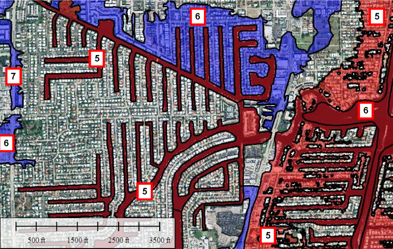
New Flood zone designations per Flood Insurance Rate Map (FIRM)
Red Designates AE flood zone with Base flood elevation of 5 and 6 feet (NGVD 1988).
Blue Designates AH flood zone with Base flood elevation of 6 and 7 feet (NGVD 1988).
Our Research and Development Team has been reviewing the Borward County new flood insurance rates maps. Our research will determine the accuracy of the new flood zone limits, the statical data for the flood zone changes, the economical impact of the new flood zones and various other issues. Please visit our research and developmet page for more information.
Florida Floodzone Services
461 SE 3rd Terrace
Pompano Beach, FL 33060
ph: 954-290-7420
bspencer